Dorian Anderson
Class of 2023 and 2024 graduate of the University of Illinois with a Bachelors in Urban Studies and Planning and minor in Geography & GIS, and Masters in Urban Planning, this portfolio covers the urban design, cartography, and graphic design work created over the last five years.
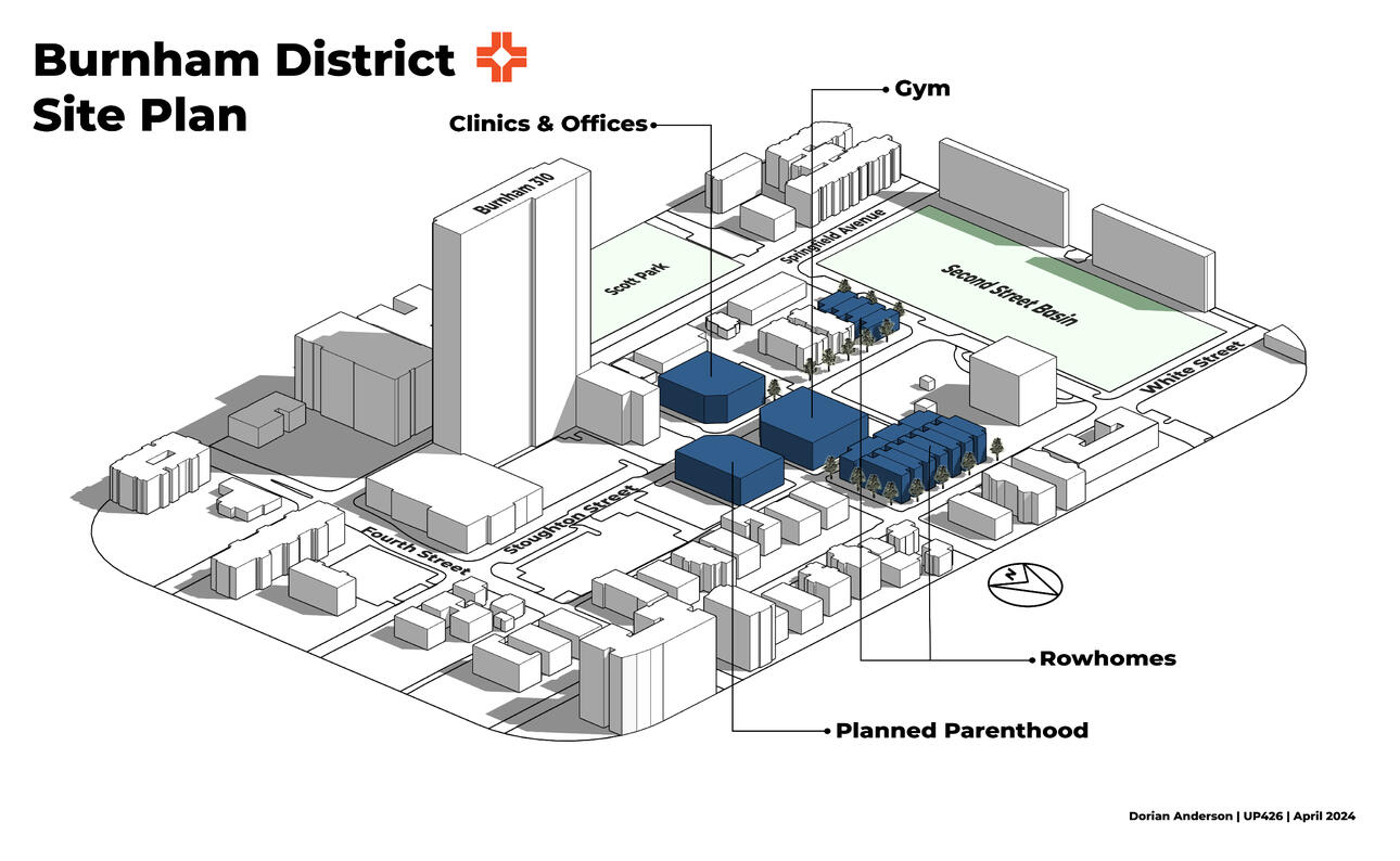
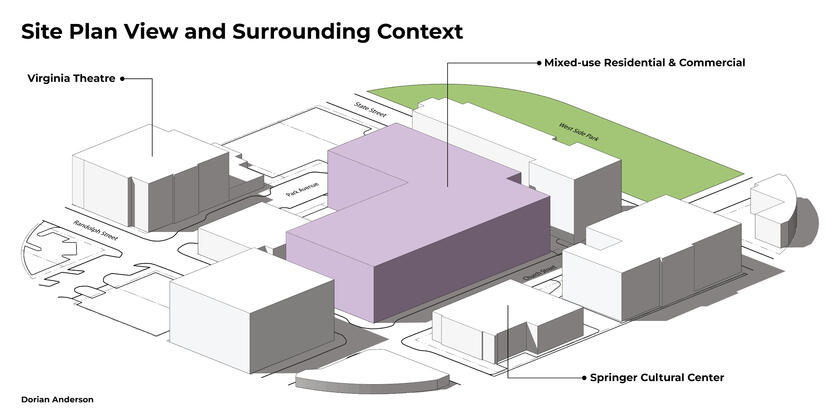
Campustown, Champaign, IL Infill Proposal - Created using ArcGIS Pro, SketchUp, and Adobe Illustrator. For UP426 Spring '24
Urban Design
With a keen eye for the revitalization and beautification of our cities, I hope to incorporate good urban design in every project I touch. With a focus on transportation, community outreach, and strong urbanist principles, our cities should be robust, beautiful, and safe.
Downtown Champaign, IL Infill Proposal - Created using ArcGIS Pro, SketchUp, and Adobe Illustrator. For UP447 Fall 22'
Streetscapes
Both in digital and physical media, my work on street design and flow has been honed by the excellent education received at UIUC.
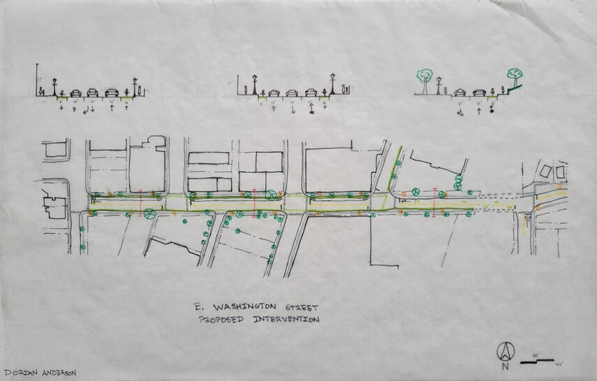
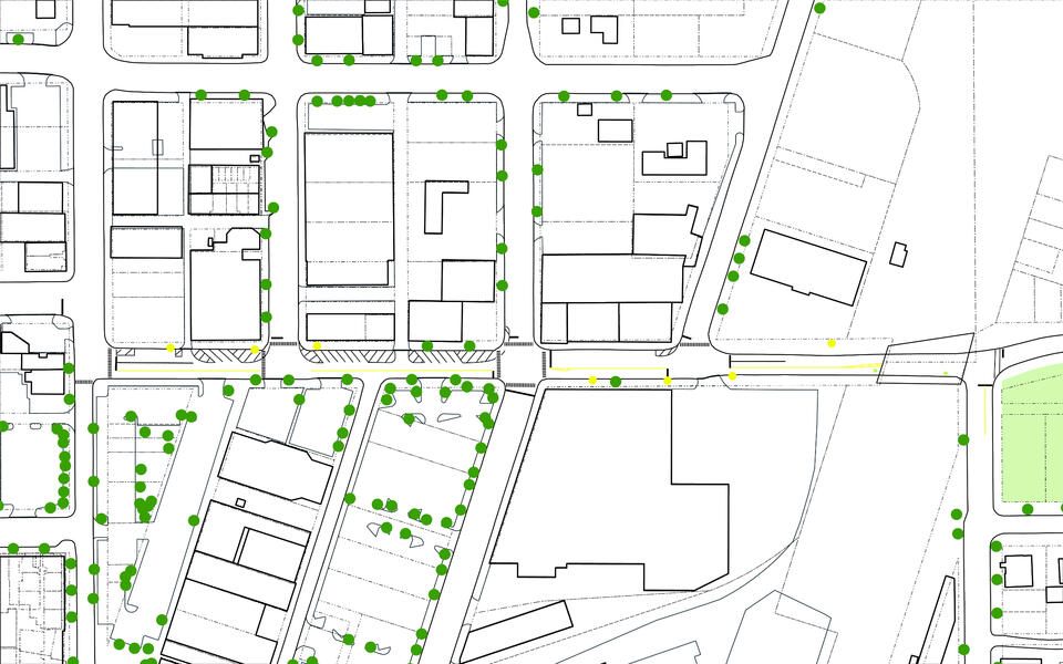
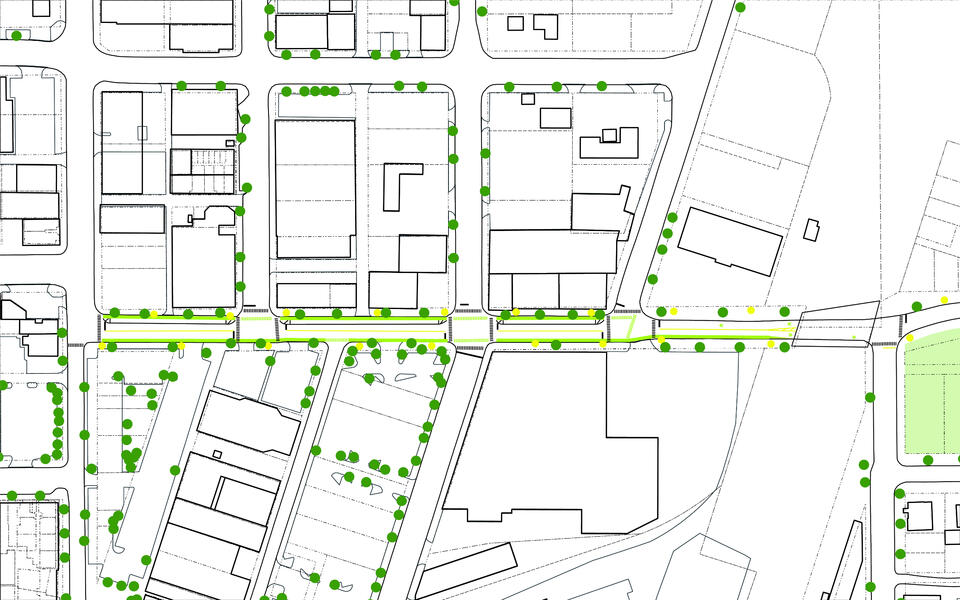
Washington Street Proposed Intervention - Pen on Trace - for UP447 Fall 22'
Washington St. Design - Before
Washington St. Design - After
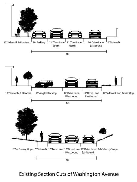
Washington St. Transects - Before
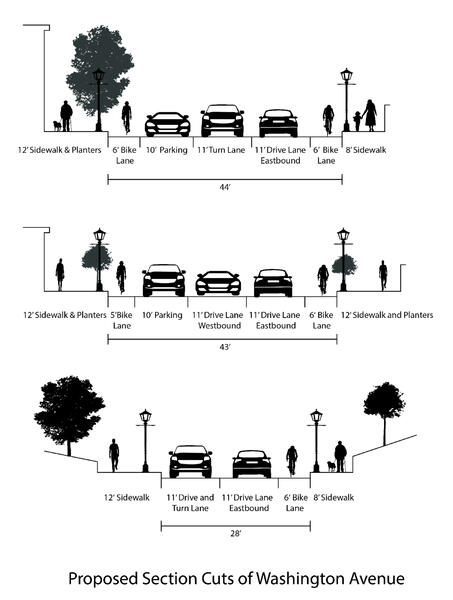
Washington Street Transects - After


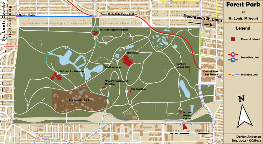
Map of Forest Park, St. Louis created using ArcGIS Pro and Adobe Illustrator.
Final project for GGIS473 Fall 22'
Digital Cartography
Using a combination of ArcGIS's suite of products, Adobe Illustrator, and other photo/cartographic software, I create digital maps for aesthetic enjoyment and educative purposes.
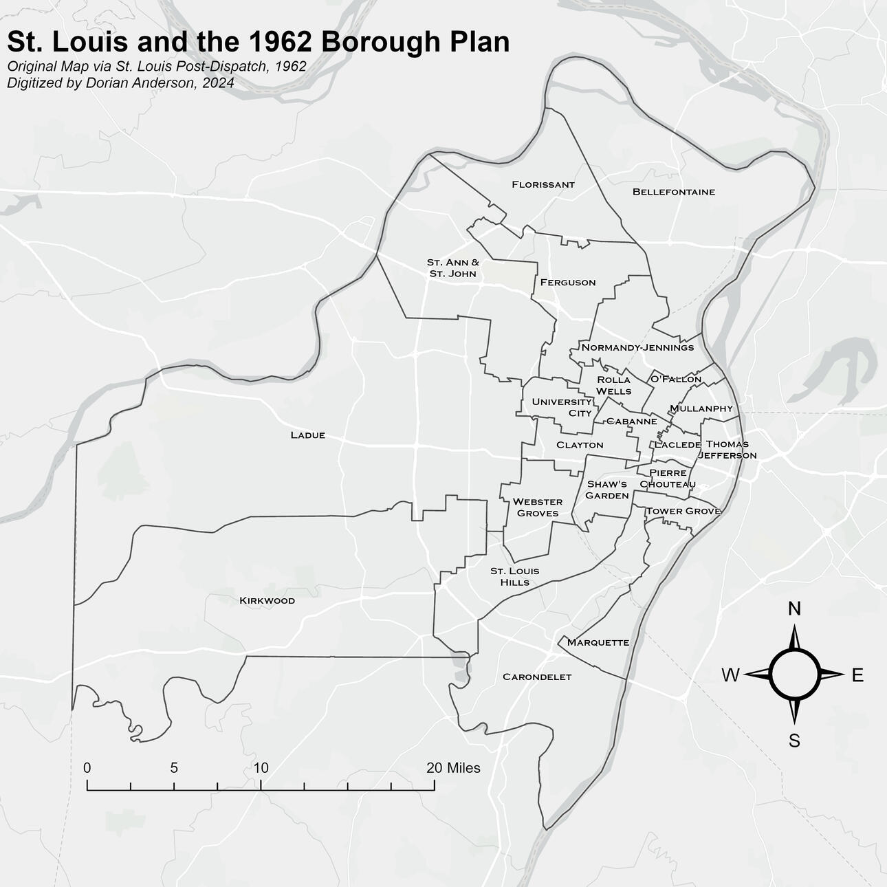
Via ArcGIS Pro, a digitization of a St. Louis Post-Dispatch graphic from 1962 showing a proposed restructuring/remerging of the St. Louis polity. Personal Project Spring 24'
Graphic Design
Born out of a desire to create original worlds and real one's reimagined; vexillology, the study and creation of flags, introduced me to the world of good graphic design. This has since expanded into officially commissioned works like seen in local municipalities and schools.
Logo for my alma mater, the Lindbergh High School Orchestra. Created using GIMP and Adobe Illustrator. Image redirects to orchestra's Instagram page.

Redesign of the Flag of Missouri
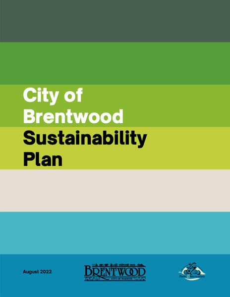
Cover Page for City of Brentwood's Sustainability Plan

Flag of Fictitious Nation

Logo for Fictitious Space-Program